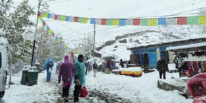
Rain and snow forecast from Thursday

KATHMANDU:- Weather forecasts indicate that a low-pressure system developing in the Bay of Bengal could intensify into a cyclone. Its impact is expected to begin in Nepal starting next Wednesday and expand from Thursday onwards. As the weather impact may intensify further on Friday and Saturday, the public is advised to exercise caution.
According to the Department of Hydrology and Meteorology, the weather across the country will be generally cloudy on Wednesday. There is a possibility of light rain and snowfall in the high-altitude (himalayan) regions of Koshi, Bagmati, and Gandaki provinces, and scattered rain in the hilly regions. From Thursday onwards, moderate rain accompanied by thunderstorms and lightning, along with snowfall, is likely in many places across Koshi, Madhesh, Bagmati, and Gandaki provinces.
On Thursday, there is a possibility of heavy rain or snowfall in one or two places within the Himalayan and hilly regions of Koshi, Bagmati, and Gandaki provinces. The Department forecasts that rain and snowfall may also occur in some areas of Lumbini Province, as well as in a few locations within Karnali and Sudurpaschim provinces.
On Thursday, there is a possibility of heavy rain or snowfall in one or two places within the Himalayan and hilly regions of Koshi, Bagmati, and Gandaki provinces. The Department forecasts that rain and snowfall may also occur in some areas of Lumbini Province, as well as in a few locations within Karnali and Sudurpaschim provinces.
The Department has stated that the risk of floods, landslides, debris flows, and soil erosion may increase due to potential rain and snowfall. As adverse weather conditions could impact sectors such as agriculture, health, tourism, mountaineering, and both road and air transport, the public is urged to exercise necessary caution and stay updated with the latest information issued by the Department.