
Bay of Bengal cyclone to bring rain to Nepal from Thursday
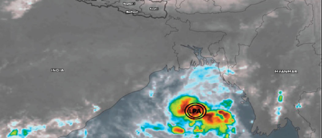
KATHMANDU:- A cyclone developing in the Bay of Bengal is likely to bring rainfall to several parts of the country from Thursday, with some places expected to receive heavy rain.
The weather system is also expected to affect Kathmandu Valley, while farmers have been advised to harvest and bring in their paddy crops by Wednesday afternoon.
According to Rojan Lamichhane, a meteorologist at the Meteorological Forecasting Division under the Department of Hydrology and Meteorology (DHM), the cyclone named Arnab is intensifying and is expected to develop into a severe cyclonic storm before making landfall near Yanam, between Andhra Pradesh and Visakhapatnam in India, on October 28.
The system is expected to gradually weaken as it moves inland towards Nepal, but it is likely to affect the country’s Himalayan and hilly regions, with a greater impact expected in the Himalayas, Lamichhane said.
From Friday to Saturday, moderate rainfall accompanied by thunderstorms, lightning and strong winds is likely at many places in Koshi, Madhes, Bagmati and Gandaki provinces. A few places in these provinces may receive heavy rainfall.
Some places in Lumbini, Karnali and Sudurpashchim provinces are also likely to receive moderate rainfall, with heavy rainfall possible at a few locations. According to a special post-monsoon bulletin issued by the DHM on Monday, rainfall may begin on Thursday and continue through Friday and Saturday. Cloud cover is expected to increase from Wednesday.
The bulletin said that while major river basins nationwide are expected to remain at normal levels on Wednesday, rainfall activity will cause water levels to begin rising by Thursday across the Narayani, Koshi, Bagmati, and Kamala basins.
Between Friday and Saturday, continuous heavy rainfall is projected to push river flows to their peak levels — approaching warning and vigilance thresholds — particularly in the Narayani, Koshi, Bagmati, Kamala, and Tinau basins, alongside minor surges in the Mahakali, Karnali, West Rapti, and Babai rivers.
The DHM also highlighted that the primary hazards during this storm event are concentrated in the hilly, Chure and Terai catchments, where small rivers and tributaries face high risks of flash floods and waterlogging.
Farmers have been advised to complete agricultural activities, including harvesting and bringing in paddy crops, before Thursday, as moderate rainfall is expected across many parts of the hills and Tarai, with heavy rainfall possible in a few places.
The DHM has also urged people to remain alert in the high hills and Himalayan regions, where heavy snowfall, snowstorms and avalanches are possible. Tourists have been advised against travelling to high Himalayan areas, while those already there have been urged to stay in safe places.
The weather system may also bring colder conditions, trigger landslides in vulnerable areas and along roads, and disrupt road and air transport as well as daily life. The public and concerned agencies have been urged to take necessary precautions and make preparations in advance.
The system’s influence is expected to gradually weaken from Saturday night, Lamichhane said.